
Attraction
Călimani Mountains, Mureș side
The Călimani Mountains, the largest volcanic massif in Romania, are bounded to the south by the Mureș valley, which separates them from the Gurghiu Mountains through the Toplița-Deda gorge. Nearly half of Călimani National Park lies in Mureș County, in the communes of Lunca Bradului, Răstolița and Stânceni. From the Mureș side, the longest route climbs from Lunca Bradului along the Ilva valley to Pietrosul Călimanilor peak (about 2,100 m).
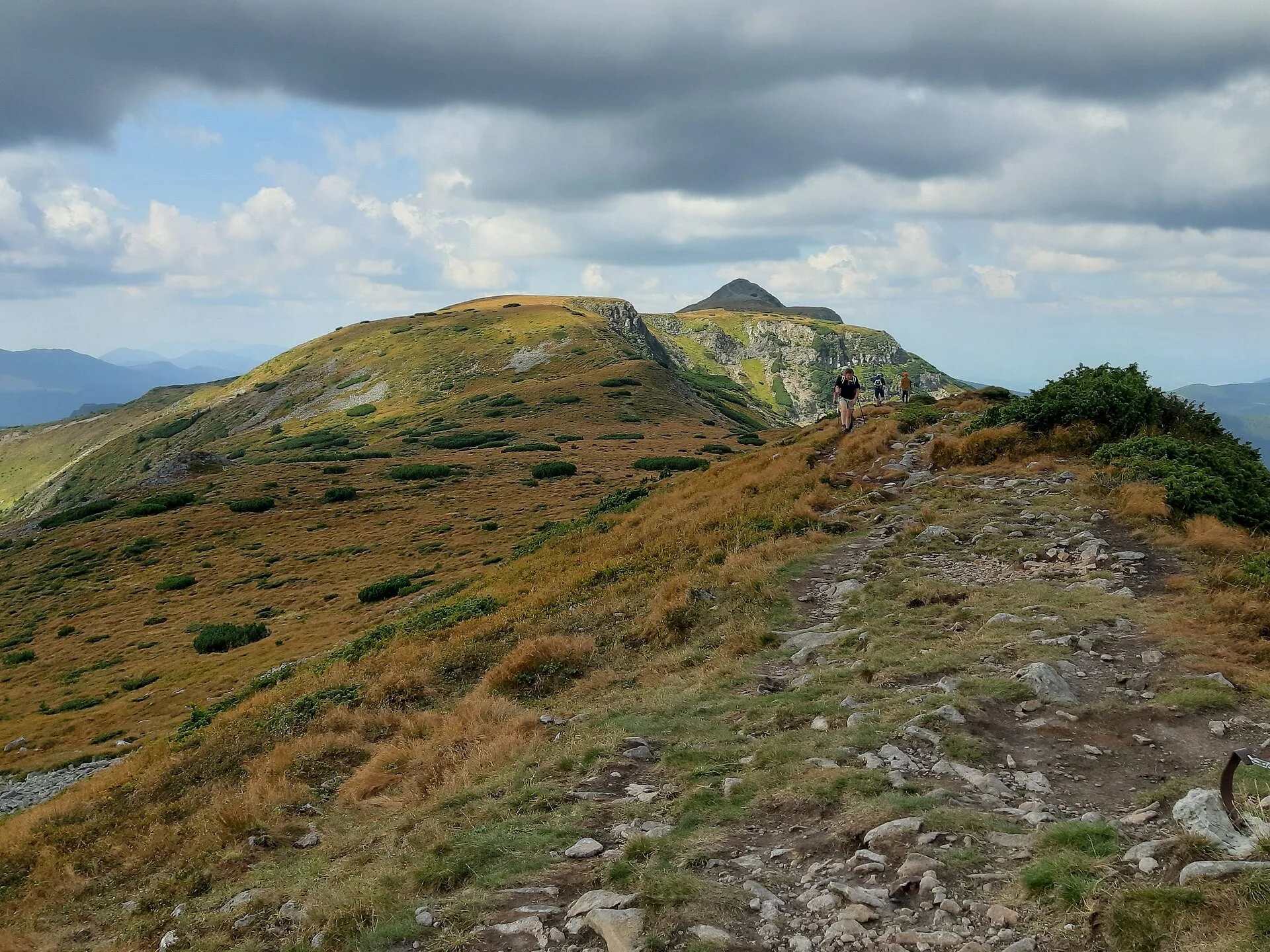
Foto: MiHai350T, CC BY-SA 4.0, via Wikimedia Commons (imagine decupată)
The Călimani Mountains occupy the north-western part of the central group of the Eastern Carpathians and are the largest volcanic massif in Romania. To the south, the Mureș valley, along the Toplița-Deda gorge, separates them from the Gurghiu Mountains. The massif is a stratovolcano built of lava, agglomerates and ash, with a caldera about 10 km across, rimmed by the highest summits: Pietrosul Călimanilor (about 2,100 m), Negoiul Unguresc, Iezerul Călimanilor and Rețițiș, all above 2,000 m. The former sulphur quarry, opened in 1976 inside the crater, is now an enclave within the national park.
Călimani National Park (IUCN category II) was declared a protected area by Law no. 5 of 6 March 2000 and covers more than 24,000 hectares in the counties of Mureș, Suceava, Harghita and Bistrița-Năsăud. The Mureș part, nearly half of the total area, belongs to the communes of Lunca Bradului, Răstolița and Stânceni. The park includes the Doisprezece Apostoli (Twelve Apostles), Iezerul Călimanului and Jnepenișul cu Pinus cembra reserves and overlaps the Natura 2000 sites ROSCI0019 Călimani-Gurghiu and ROSPA0133 Munții Călimani. It is managed by Romsilva through the Călimani National Park Administration, based in Șaru Dornei (Suceava County).
On the Mureș side, the route to Pietrosul Călimanilor starts at the mouth of the Ilva stream, in the upper part of Lunca Bradului village. A forest road, passable by car up to the confluence of the Negoiu and Pietrosul streams, covers almost 18 of the route's 26 km. From there a path marked with a blue cross climbs steeply through the forest, past a sheepfold with a spring (the last water source), to Șaua Negoiului saddle; the ridge path marked with a red stripe then leads to Negoiul Unguresc, from where Pietrosul is about half an hour's walk away.
In the south-west of the massif, Scaunul Domnului peak (1,381 m), an andesite erosion remnant, can be climbed from the village of Bistra Mureșului on the blue stripe trail or, on a longer route marked with a blue dot, from the village of Gălăoaia. At the entrance to Sălard village (Lunca Bradului commune), a short, steep trail marked with a red dot climbs to the Sărăcin Rocks, which overlook the Mureș valley. The park is home to brown bear, wolf, lynx, red deer, capercaillie and golden eagle, and its conifers include Swiss stone pine and dwarf mountain pine.
Munții Călimani, comunele Lunca Bradului, Răstolița și Stânceni, județul Mureș